Case studies

Where the twin is already at work

Cities, public companies and European programmes: each project is a layer of the twin, from the paper archive to the survey of an entire network.

Milan — roads and sidewalks degradation index
What we delivered — Milan — roads and sidewalks degradation index
What we delivered

2026 · Milan, Italy · MM S.p.A.

Milan — roads and sidewalks degradation index

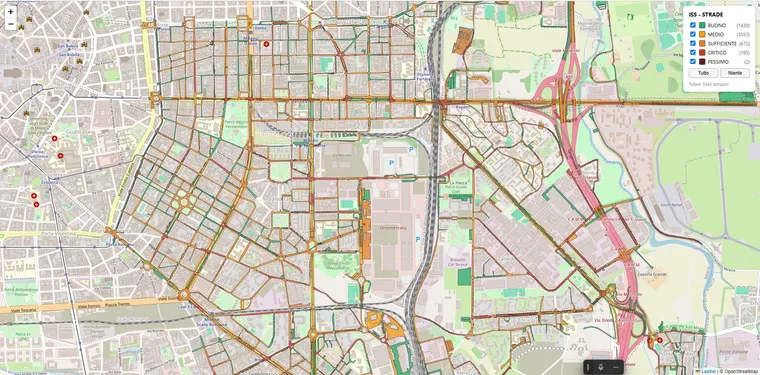
For MM S.p.A., which manages the roads and sidewalks of the City of Milan, an AI survey scores every road and sidewalk segment on a five-level degradation index. The first batch, Municipio 4, has been delivered; the rollout covers about 2,000 km.

What was measured

  • 33,553 defects on roads and sidewalks in Municipio 4
  • 7,792 segments scored on a five-level index
  • Roads and sidewalks captured in the same pass

Outcome

  • An objective, comparable ranking of condition across a very large network
  • Maintenance and pedestrian safety prioritised on measured data
  • Delivered as GIS layers, one municipio at a time
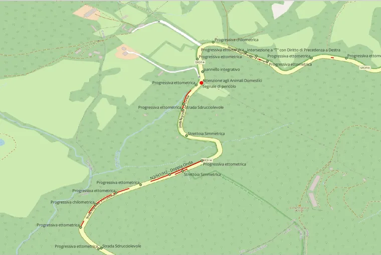
Vertical signage and guardrail inventory
What we delivered — Vertical signage and guardrail inventory
What we delivered

2026 · Extra-urban roads, Lazio, Italy

Vertical signage and guardrail inventory

For Phacelia, a road-monitoring company, a computer-vision survey built a georeferenced catalogue of vertical signs and safety barriers across 1,500 km of extra-urban roads. What started as a proof of concept became four lots.

What was measured

  • More than 20,000 vertical signs
  • Guardrails and safety barriers
  • Type and position of every asset

Outcome

  • 1,500 km inventoried, in four lots
  • About ten hours of driving per lot
  • Delivered as GIS shapefiles, ready for the client’s system
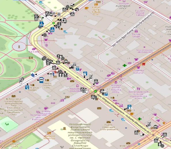
Lviv — from paper archive to living inventory
What we delivered — Lviv — from paper archive to living inventory
What we delivered

2026 · Lviv, Ukraine · EIT Urban Mobility RAPTOR

Lviv — from paper archive to living inventory

Lviv has no digital record of its signage: crews work from paper archives and field visits. With RAPTOR 2026, LOKI turns the paper traffic plans into a GIS inventory, adds a baseline scan with three cameras, and hands the city the tools to keep the twin alive.

What was measured

  • 147 traffic plans read in the city-centre pilot
  • About 2,000 signs and 150 traffic lights placed on the map
  • Status and approving document attached to every asset

Outcome

  • City-centre inventory complete and reviewed
  • Next: a baseline scan of more than 200 km of roads
  • Target: changes on the street detected within 24 hours, run by the city
Bari — quality control on road restorations
What we delivered — Bari — quality control on road restorations
What we delivered

2025 · Bari, Italy · City of Bari

Bari — quality control on road restorations

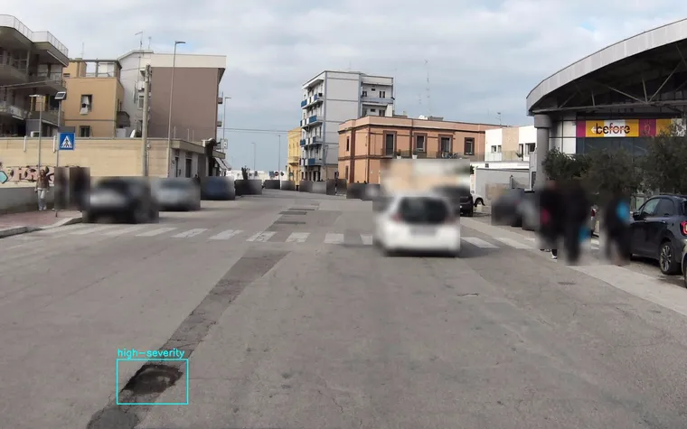
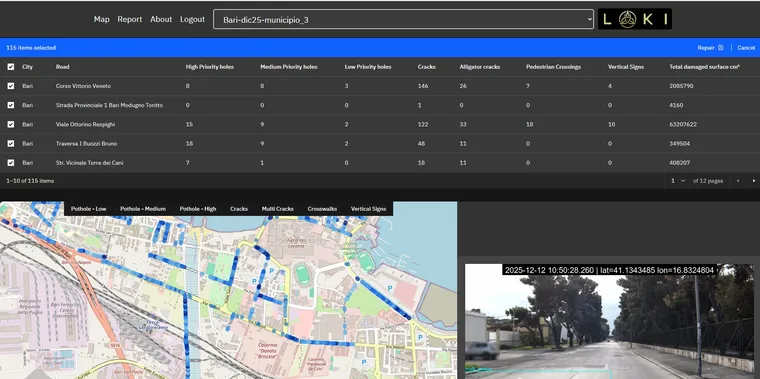
The City of Bari needed objective data on streets recently dug up by third-party utility companies. One vehicle scanned about 200 km of the municipal network, and the georeferenced defect map became the quality check on how each excavation had been reinstated.

What was measured

  • Surface defects on reinstated excavations
  • Potholes, cracks and deformation across the network
  • Every record with an authenticated position

Outcome

  • About 200 km scanned in 13 hours of driving
  • Objective evidence to hold contractors to the required standard
  • No lane closures and no slow manual inspections
Las Rozas de Madrid — EIT Urban Mobility RAPTOR
What we delivered — Las Rozas de Madrid — EIT Urban Mobility RAPTOR
What we delivered

2024 · Las Rozas de Madrid, Spain

Las Rozas de Madrid — EIT Urban Mobility RAPTOR

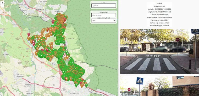
LOKI won the RAPTOR call from EIT Urban Mobility and scanned the whole city with AIPECRA, scoring the accessibility of every pedestrian crossing for people with reduced mobility.

What was measured

  • More than 2,400 crossings geolocated and scored
  • Width, ramps, slopes, markings and signage of each crossing
  • Steps, kerbs and obstacles that break an accessible route

Outcome

  • More than 500 km of roads covered: the whole city
  • Every barrier delivered to planners as a ranked list
  • An accessibility layer ready for the city’s digital twin

Programmes and partners

Let’s keep your infrastructure alive

Send us a street, a district, a box of paper plans or an entire network. We will build the first layer of your twin, and you decide whether the numbers are worth a conversation.