
The Living Digital Twin
From a single observation to the entire territory.
Measured, authenticated, predicted. LOKI builds a digital twin of your road infrastructure and keeps it alive: the archive you already own made searchable, every asset measured from ordinary vehicles, every observation authenticated by Galileo, the ground read from space.
The living baseline, in four numbers
- 3 cameras industrial cameras in one plug-and-play device, on any vehicle
- 130 km/h survey speed, with no lane closures and no dedicated fleet
- 3 cm position accuracy with RTK, 20 cm with Galileo HAS, every point authenticated
- 10 × cheaper than laser-based surveys, so the twin is refreshed instead of bought once
01 · Observed on the ground
Real footage, recorded on the road
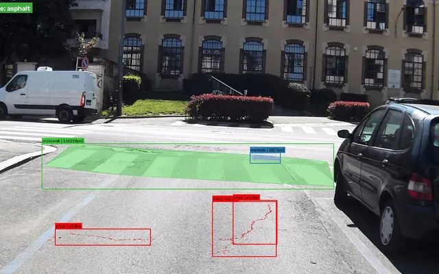
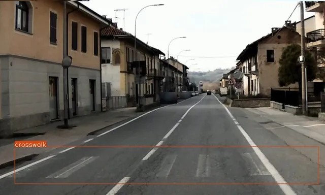
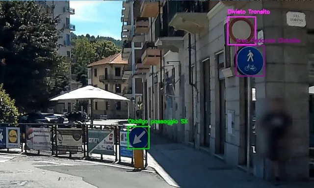
What our on-board camera sees and what the model recognises: road surface, markings, signs, barriers and defects. Faces and number plates are anonymised.
- Extra-urban road
- City streets
- Residential street
Our solution
Your city, layer by layer.
The questions you are accountable for, answered with measured, authenticated data: where to spend the maintenance budget, what you own, what is at risk, and what the climate will do next.
One survey from ordinary vehicles, plus satellite data. Every layer in the same twin, kept up to date.
- 01 Pavement condition Which roads do we fix first?
- 02 Sign inventory Is our signage complete and compliant?
- 03 Flooding Where do drains clog and water pool?
- 04 Ground subsidence Where is the ground moving?
- 05 Heat islands Which districts overheat?
Why it matters
Behind every defect, someone on their way
-

Every pothole is on someone’s way
On foot, on a bike or at the wheel, people meet the road’s defects long before a survey does. On two wheels, a pothole is a fall.
-

A crossing drivers cannot see
For an elderly person, faded stripes or a crossing hidden at night turn a short walk across the road into a risk.
-
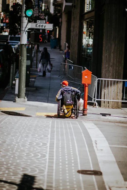
One barrier closes a route
For a wheelchair user or a parent with a pram, a single kerb without a ramp is enough to make a whole route unusable.
101 million Europeans live with a disability and more than 90 million are over 65. The EU aims to halve road deaths and serious injuries by 2030.
























Reality changes every day. Knowledge does not.
Public infrastructure is managed with knowledge that is already dead: paper archives, outdated surveys, disconnected platforms, digital twins bought once and never updated. Whoever is accountable for it cannot answer three questions with defensible data.
-
What do we have?
The inventory is spread across paper plans, old drawings and platforms that do not talk to each other, so nobody can say for certain what is on the network.
-
What condition is it in today?
Surveys are expensive, so they are rare, and by the time the next one comes the last one no longer describes the road.
-
What will fail next?
Without history and context every intervention is a reaction, and with climate accelerating decay, reacting costs up to six times more than preventing.


Ground data + space data
From orbit to asphalt
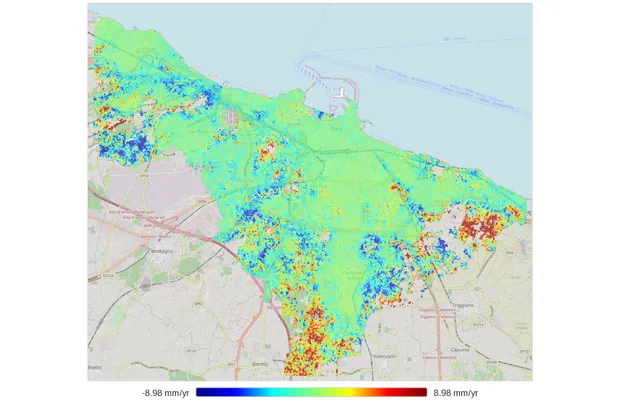
The same stretch of road, seen from three altitudes. Each layer answers a question the others cannot, and together they turn a pothole into evidence.
- 23,222 km
Galileo
Where, provably
Galileo OSNMA authenticates every observation in time and position, so a coordinate holds up in a dispute or an insurance claim. Galileo HAS brings it to 20 cm, RTK to 3 cm.
- ≈ 700 km
Copernicus · InSAR
Why it keeps breaking
Radar interferometry measures ground motion beneath the road in millimetres per year: the subsidence that makes a patched pothole reopen. Developed during our incubation at ESA BIC Turin.
- ≈ 1.5 m
Vehicle · edge AI
What, and how bad
Three cameras and an inertial unit feed a model running on board, which finds and grades every defect at traffic speed.
- 20 cm
On the asphalt
A repair you can find
Every defect pinned close enough that a crew arrives and sees it without searching, with the source image attached.

Why LOKI
Accurate, authenticated, affordable enough to repeat
Two ways to work with us
Born once, kept alive every day
Neither model asks you to buy a new fleet.
-

Data as a service
The twin is born
We run the first scan and the periodic refreshes with our own vehicles. You receive the twin: a first baseline, then updates at the frequency your network needs.
-
Hardware as a service
The twin stays alive
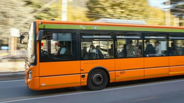
The device rides on vehicles that already cover your network every day, such as buses or waste trucks, and the twin updates as they do their rounds.
Already running on real networks
More than twenty projects for municipalities, EU programmes and companies in Italy, Spain and Ukraine, with customers coming back for more: a second campaign in Chivasso, Open Fiber growing from two to ten municipalities, Phacelia’s proof of concept grown into four lots.
-

2026 · Milan, Italy · MM S.p.A.
Milan — roads and sidewalks degradation index
For MM S.p.A., which manages the roads and sidewalks of the City of Milan, an AI survey scores every road and sidewalk segment on a five-level degradation index. The first batch, Municipio 4, has been delivered; the rollout covers about 2,000 km.
Read more -

2025 · Bari, Italy · City of Bari
Bari — quality control on road restorations
The City of Bari needed objective data on streets recently dug up by third-party utility companies. One vehicle scanned about 200 km of the municipal network, and the georeferenced defect map became the quality check on how each excavation had been reinstated.
Read more -
2024 · Las Rozas de Madrid, Spain
Las Rozas de Madrid — EIT Urban Mobility RAPTOR
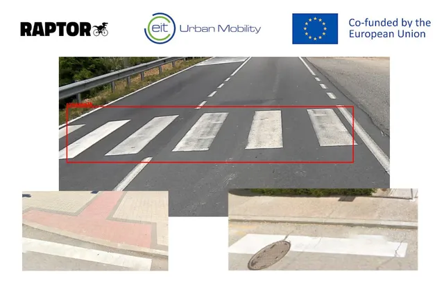
LOKI won the RAPTOR call from EIT Urban Mobility and scanned the whole city with AIPECRA, scoring the accessibility of every pedestrian crossing for people with reduced mobility.
Read more
Let’s keep your infrastructure alive
Send us a street, a district, a box of paper plans or an entire network. We will build the first layer of your twin, and you decide whether the numbers are worth a conversation.